Overview
LiRo-Hill staff designed and built the New York City City-wide Street Centerline (CSCL) database and the CSCL Maintenance System. CSCL was created to provide for a single, accurate, and authoritative database to support Computer-Aided Dispatch (CAD) operations of NYPD and FDNY. This database is a versioned Esri Enterprise Geodatabase that stores millions of records (e.g. street centerlines, address points, common places) that digitally model the complex geography of NYC. CSCL is maintained on a daily basis by the City’s Centerline Maintenance Group (CMG). The CSCL data has successfully processed over 100 million e911 calls since 2013.
About the Project
Phase II – LiRo-Hill worked with the Department of Information Technology and Telecommunications (DoITT), the New York City Department of City Planning (DCP), and other City agencies to enhance the City’s existing street centerline (“LION”) and to build new datasets. The Citywide Street Centerline (CSCL) dataset is used to create extracts that are loaded on a weekly basis into the public safety CAD systems to improve the accuracy of dispatching.
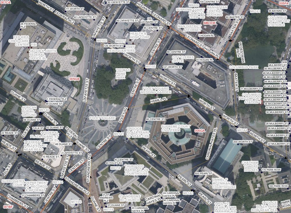
Phase III – Phase III of the project was the creation of a system to maintain the data created as part of the CSCL Phase II project. The CSCL Maintenance System replaced the Department of City Planning’s older system used to maintain the LION file as well as provide tools for DoITT’s staff to maintain features such as common places and address points. The CSCL Maintenance System extends the capabilities of ArcGIS for Desktop (using class extension architecture) and leverages the functionality of ArcGIS for Server to support server-side functions (e.g. tools to perform complex queries, validations, and comparisons that are run on a scheduled basis and consume considerable system resources or time to run).
Phase IV – Phase IV of the CSCL project was the development and ongoing maintenance of software to extract, transform, and load the CSCL data into the native format of public safety agency’s CAD systems. This software supports the continuous evolution of dispatch operations as well as changes to the core CSCL data.
Project Challenges & Solutions
The sheer size of data development (over 1 million address points and 170,000 street centerlines) and its critical importance required an extensive quality control and quality assurance (QA/QC) program to ensure that the data met the City’s requirements for dispatch and response. There was very little tolerance for errors in data, which fostered the development and execution of a comprehensive QA/QC program, which involved field verification, manual inspection, and automated geospatial routines.
Outcome
Before the CSCL project was undertaken, FDNY and NYPD had separate computer-aided dispatch databases. With the advent of CSCL, there is a single database with common attribution and defined custodians for each dataset. The project also created the CSCL Governance Committee, which meets regularly to discuss policy, data issues, improvements to process, and to promote data sharing.