Overview
As one of its services to Yonkers Public Schools (YPS), LiRo-Hill’s Environmental Group conducts various inspections, including laboratory tests. Typically, the data collected is identified by a space number (i.e. 0102), a descriptive location (i.e. Room 109a Auto Shop), the material (i.e. Cove Base & Mastic (Brown), a quantity (i.e. 234 lf), and a series of assessments taken (i.e. Friable/ Non-Friable, Condition Category). The data is delivered in a spreadsheet with a series of sheets. One of the concerns was that the data delivered in spreadsheet format can be overwhelming, given the sheer volume of data, and difficult to visualize quickly where issues may exist. LiRo-Hill proposed a different approach to delivering the 2019 Triennial Inspection – with the use of Building Information Model (BIM) and Geographic Information Systems (GIS). YPS agreed and selected Saunders High School as the pilot location.
About the Project
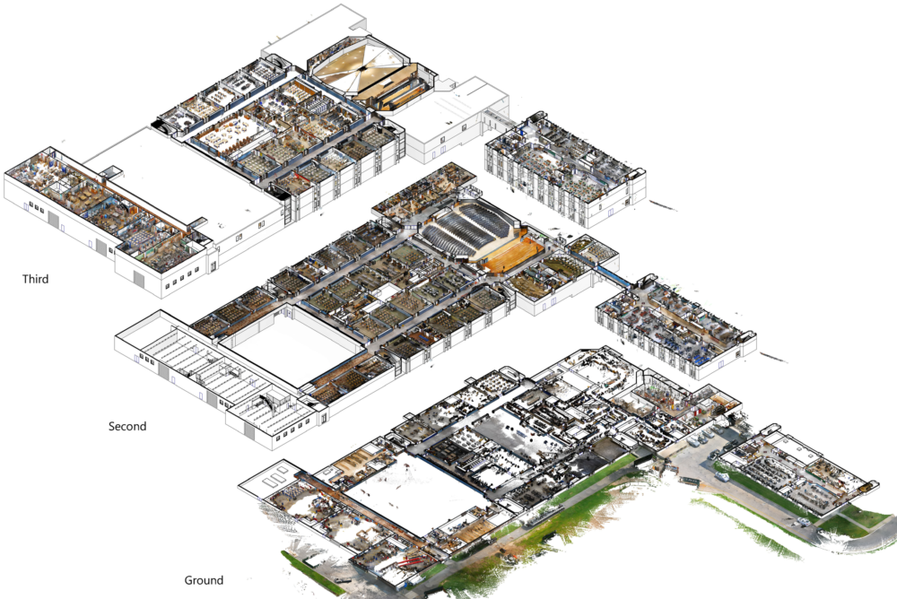
Using a mobile LiDAR, LiRo-Hill quickly scanned all three floors of Saunders High School and created an extremely precise 3D model. Individual features such as water fountains were accurately collected. This model was used to create accurate 2D digital floorplans, which also served a dual purpose as “as-builts” or current conditions within the school. Using these floorplans, LiRo-Hill was able to create GIS layers, using the YPS standard GIS technology (esri). The data from the spreadsheet was migrated to a database, which provided for a much higher level of standardization. Because of the accuracy of the scanning and modeling, LiRo-Hill was able to link inspection and test results to individual rooms and some cases down to the smallest feature (i.e. a water fountain).
Outcome
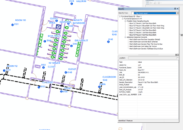
YPS can now visualize the inspection results and simply “click” a point and obtain testing information. The future goal is to start with the model and GIS then enter data into a database instead of a spreadsheet. This approach will better control the quality of the inspection and testing data, identify space and individual components more efficiently, and provide the ability to analyze inspection results over time and space.